During the 1950s the Irish Air Corps undertook a coastal survey. These photographs were taken from above the water, looking obliquely on the coastal fringe, and show the Breaches, Sea Road, and houses in Cooldross, Ballydonarea, Ballygannon, and Ballynerrin townlands.
Greyfort House
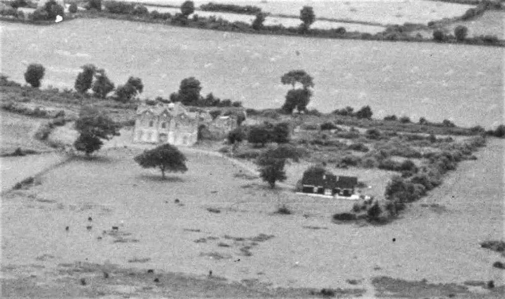
Greyfort House, which itself replaced an older house known as Ballydonarea House (not to be confused with the Ballydonarea House to the north, which still stands). This house was lived in by a succession of wealthy farmers until it fell into disrepair and was pulled down sometime in the 1960s. The courtyard and some stable ruins can still be seen to the rear of a modern Greyfort House which was built in the last decade.
The name “Greyfort” is a translation of the Irish townland name, normally spelled “Ballydonarea”. Some say that Ballydonarea refers to the owner of these lands at the time of the Down Survey (Baile Dhonncha Riabhaigh, Donncha the Grey, or Donncha the Brindled). Others suppose it is Baile Dhun Na Ri, place of the King’s Fort; still others, Baile Dhun Riabhaigh, Grey Fort. The name Greyfort is first documented in the 1860s; prior to this, the house and lands were known as Ballydonarea. When the original house was rebuilt or renamed, another house to the north but on the same estate became known as Ballydonarea, and is known as such to this day.
Ballygannon Demesne
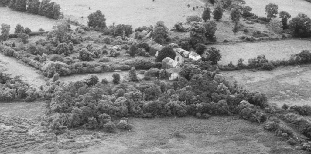
The ruins of Ballygannon Demesne on the sea. Ballygannon was an important house belonging to the O Byrne family and passing to the Scott family in the 1600s. The original mansion burned in the 1800s and a thatched two-storey house replaced it, which is visible in this photograph to the right. The last Scotts left in the 1920s and the house and stables fell into disrepair. Today several of the stables still stand and are called by locals “the lost village” as they resemble a long two-storey village street.
Sea Road
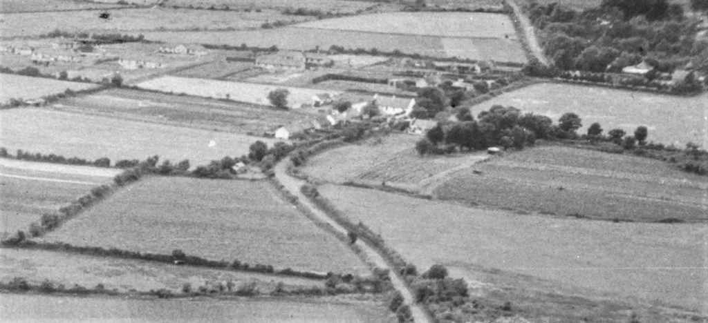
The first council houses built here are the smaller cottages nearest the sea; others built in the cul-de-sac stand on large plots of land which today have largely been lost to subdivision.
The large white house in the centre of the first photograph is an old homestead which appears on the earliest ordinance survey maps (1830s). This was the home of the Grey family, perhaps descendants of the people who gave their name to this townland (Ballydonarea, believed to be Baile Dhonncha Riabhaigh, home of Donncha the Grey). This house is still standing and is one of the oldest in the area.
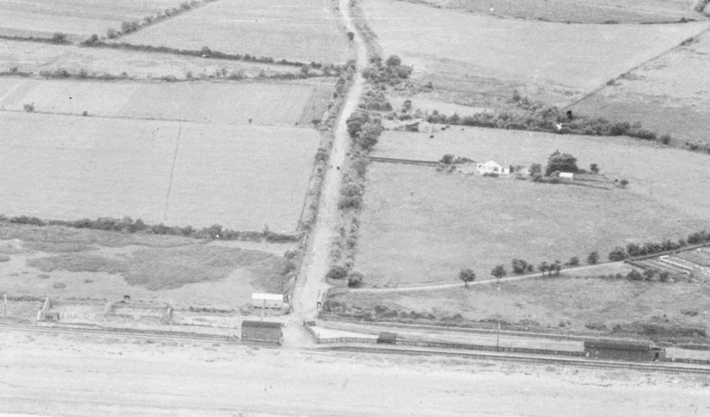
The train stop and Sea Road. Barely visible in the middle right is a small pond dug in the early 1800s or before, probably to make bricks at a brick works located near modern-day Ballydonarea House.
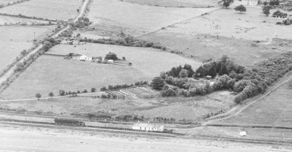
To the right of the railway siding is a house now known as Haveli Junction. The mass of trees and nursery beds is Calary House which has recently been rebuilt. A path going off to the right is an old laneway that has been preserved as a footpath to this day.
Ballydonarea House and Donleavy Cottage
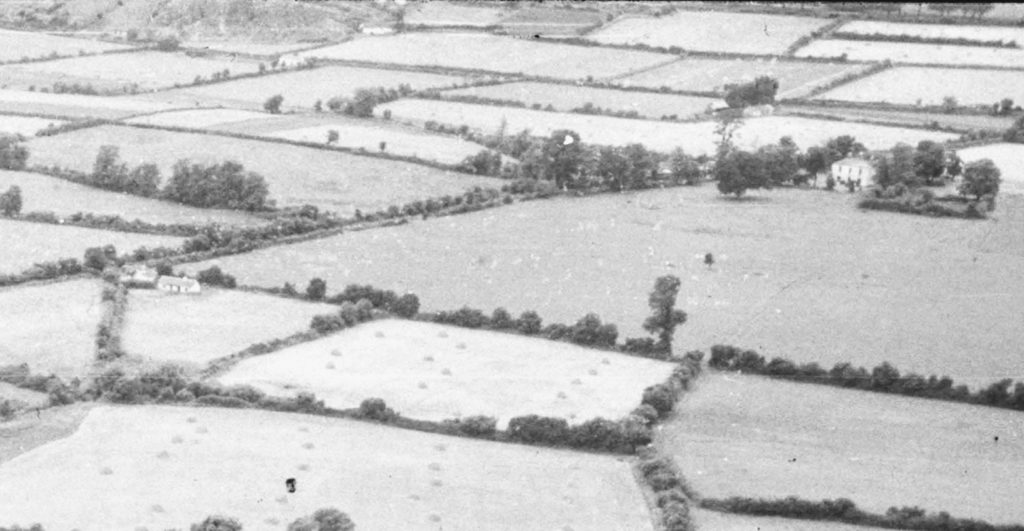
To the left, a small cottage owned at this time by J.P. Donleavy, writer and artist. To the right is Ballydonarea House which still exists.
In the background the base of the Rock can be seen.
Railway and Coastal Defenses
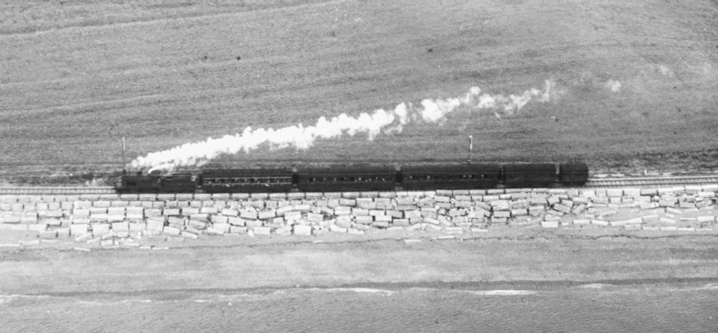
Steam train heading south to Ballygannon, above massed coastal defense blocks facing the waves.
The Breaches
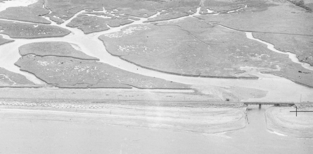
The Breaches south of the bridge, showing a more extensive flooded area than survives today.
So what has changed since the 1950s?
In most areas, there were fewer mature trees and hedgerows than there are today. Those were times when wood meant fuel. Children were sent out daily to collect whatever they could find for the fire. Disputes over damaged hedges and trees were regularly brought to the courts in the decades prior to these photographs, with landowners trying to preserve hedgerows and trees for their own use or enjoyment.
Of course with a smaller local population there were also fewer houses than today. The council houses on Sea Road were built before this time; the houses of the cul-de-sac are clearly visible in one photograph, standing in large plots of land which today have mostly been subdivided for more houses. Some of the cottages along the railway date back to the 1800s, most from the early 1900s. Caravans can be seen which still show up from time to time on these sandy plots along the sea. The era of the bungalow is clearly dawning on Sea Road, most notably the bungalow built in front of the old Greyfort mansion.
Coastal defense works are visible as clusters of concrete blocks, many of which survive today. Walkers along the coast will be familiar with these blocks which often show their year of manufacture. After the destructive storms of the 1990s, stronger defenses were designed. Some of the original blocks have been buried over during the last two decades by quarried stones carried in by ship.
The area of water and wetlands behind the Breaches was far more extensive in 1950 than today. Further draining for agriculture has reduced the area inundated during high tide, and canalised many of the remaining water channels.