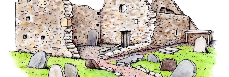
History of Kilcoole written in 1938

Approximately 740,000 pages (288,000 pages in the pupils’ original exercise books; 451,000 pages in bound volumes) of folklore and local tradition were compiled by pupils from 5,000 primary schools in the Irish Free State between 1937 and 1939. This collecting scheme was initiated by the Irish Folklore Commission. The scheme resulted in the creation of …

Woodstock Demesne

Built by Sir John Stratford in the 1770s, Woodstock House was designed by the architect Robert West who worked on many of the country’s great houses. The Tottenham family occupied the house in the late 1800s and early 1900s and were influential in civic projects in Kilcoole village. Woodstock House has been faithfully maintained and …

Darraghville House (Convent)

John Darragh, former Lord Mayor of Dublin, completed a summer and hunting house named Darraghville in 1782. The former name for these lands was Godden, and there may have been an estate here before Darragh bought the lands. Darraghville is a two-storey over basement, five-bay, Georgian residence, with a projecting semi-hexagonal bay to the west, …

Ballygannon Demesne

By the late 1600s, Kilcoole was surrounded by wealthy estates, and the largest of these was Ballygannon, located at the end of Lott Lane beside the sea. Ballygannon belonged to the O’Byrne clan, and is referenced as early as 1533 as Ballienan. Art mac Teige Byrne owned Ballygannon in 1641 but the estate was confiscated under …

Rock of Kilcoole

The existence of the quartzite outcrop known as the Rock is undoubtedly responsible for the initial settlement and location of Kilcoole. Early peoples arriving in Ireland after the last ice age would have been drawn to the Rock, from which one could spot approaching boats and erect defences. Food would have been abundant in the birds …

Kilcoole’s Coastline in 1950

During the 1950s the Irish Air Corps undertook a coastal survey. These photographs were taken from above the water, looking obliquely on the coastal fringe, and show the Breaches, Sea Road, and houses in Cooldross, Ballydonarea, Ballygannon, and Ballynerrin townlands. Greyfort House Greyfort House, which itself replaced an older house known as Ballydonarea House (not …

Censuses of 1901 and 1911

A systematic government census of the Irish population was taken every 10 years from 1821 until 1911. Sadly, only 1901 and 1911 survive in complete form. Census taking was resumed after the Civil War, in 1926, and that census will be available to researchers one hundred years after the fact (January 2027). The 1901 and …

Kilcoole’s First Census (1668)

In the decade after Cromwell, the Hearth tax was introduced and was operational in Ireland by the 1660s. To collect the tax, lists of houses were made with the number of hearths in each home. This comprises the first census we have of Kilcoole and Wicklow. Today we know these records as the Hearth Money …

Church of St Comgall

The ruins of the ancient church at Kilcoole are most often known after the name of St Comgall (Chomhghaill). The monks of St Comgall in County Down were known to have established a number of religious settlements along the Irish sea, however there are many St Comgalls in Irish history and this association is not certain. Other …

Kilcoole on the Down Survey

This map, which dates from 1658, shows “Killcool”, it’s church, several local streams, and a number of local townlands as they were surveyed after the Cromwellian invasion. It is the first known map showing Kilcoole. For more information, and to view the maps of the Down Survey, visit Trinity College Dublin’s Down Survey page. In …