Kilcoole’s Name
Kilcoole likely derives its name from a monastic cell or chapel founded by, or associated with, a man by the name of Comhghaill. Until the Irish language died out in the 1700s, Kilcoole was pronounced kill-CO-will, and until recently was usually spelled Kilcool or Killcool. Read more about the Origin’s of Kilcoole’s name.
Early History
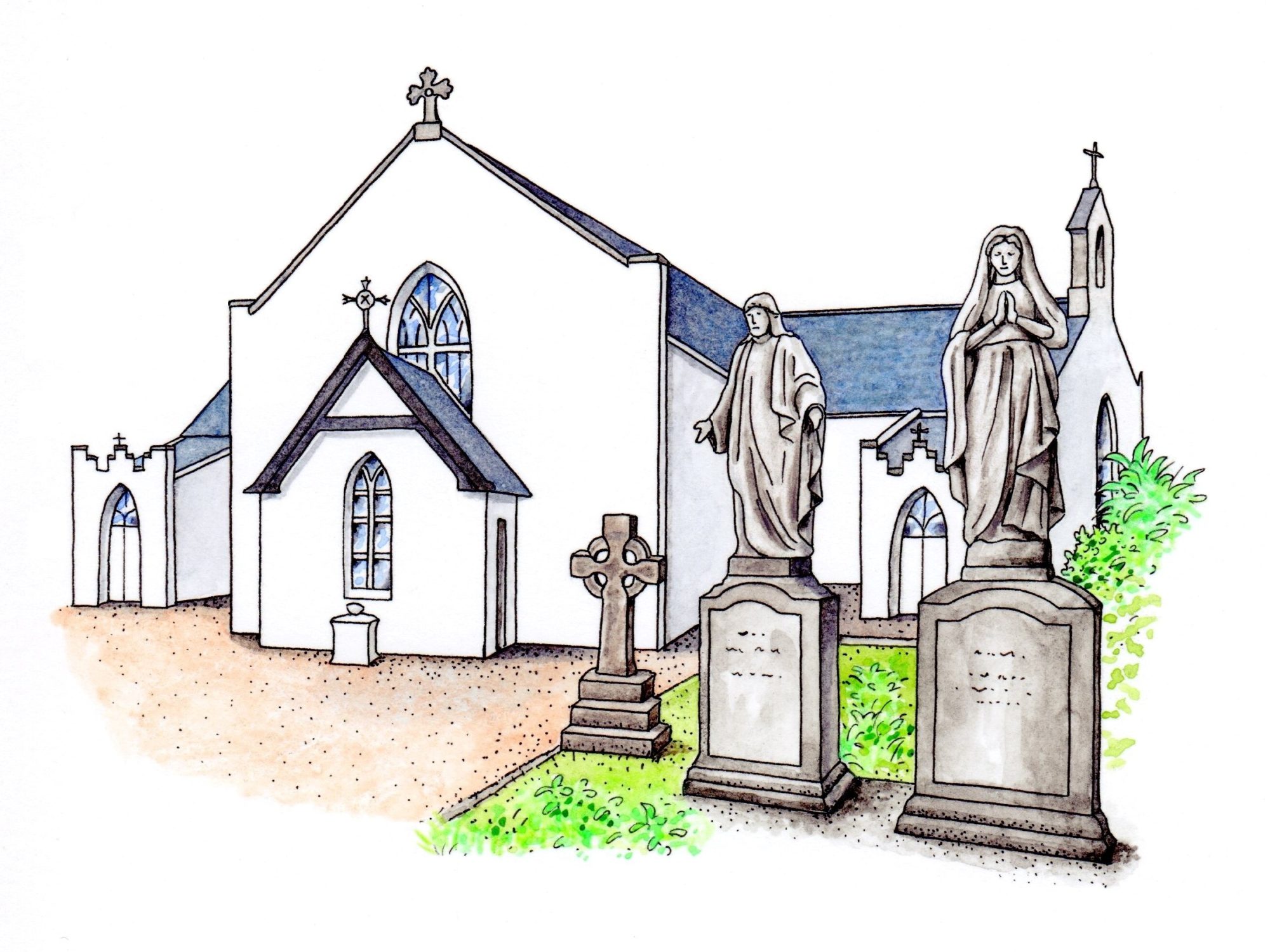
The earliest people in Ireland travelled along coasts and estuaries, gathering and hunting food that was largely marine in origin. As the climate warmed, the seas surrounding Ireland rose and our coastline moved inland. Kilcoole’s coastal marshes would have provided ample food in early times. The shingle beaches would have been a key transportation route, as travel inland would have been difficult due to thick forests and bogs. Cattle breaking through the thick undergrowth created the first simple paths linking small settlements. No doubt the first permanent inhabitants of this area were attracted to the Rock of Kilcoole for its vantage point and defensive potential. We know that Kilcoole existed by the Middle Ages; Cellcomgaill is referred to in a letter from the pope in AD 1179, and the Anglo-Norman invaders attended mass in our ancient church. Read more about the Church of St Comgall.
English Domination
The English began to be interested in Ireland again following the Reformation. The wars and famines of the seventeenth century were devastating, and had a lasting impact on the population of most areas. Many landholders in Kilcoole were killed and their lands redistributed in 1604 after the Nine Year’s War. The Confederate Wars began in 1641 with a rebellion of Irish Catholics and Royalists. A force of rebels was attacked and defeated on Christmas Day 1641 at Kilcoole. In 1649, Cromwell and his army passed through Kilcoole, spending the night at nearby Killincarrig Castle. Many people died during this invasion and in the famine following. By the decade after Cromwell, the Irish language began to disappear. Ownership of the land passed to families who either arrived from England or converted to the established church, with the majority in Kilcoole becoming landless labourers on the estates of Darraghville, Woodstock, Ballydonarea, and Ballygannon. The Norman church in Kilcoole, which had been a centre of religious worship for centuries, was abandoned by all but a few who had converted to the new faith. The outlying chapels around Kilcoole fell into disuse and eventually disappeared. By the late 1600s, the old church was no longer used; Protestants worship shifted to Delgany and Newcastle. Most of the population attended Catholic mass in secret, gathering in fields or in houses to hide from persecution.
Revival
Kilcoole began to recover somewhat with the coming of a coach road connecting Dublin with Wexford in the 1760s. Travelers on the new road needed horses and lodging, and an Inn was built at the crossroads of Main Street and Sea Road (this building survives today as Byrne’s Public House). In addition to the work on local big estates, local people began to provide services to those who stopped at the inn. Livestock fairs were held twice a year to market the produce of the big estates, and these events became the centre of the social calendar.
Changing attitudes toward religious diversity allowed a Catholic church to be built at Kilquade in the late 1700s. After being destroyed in the rebellion of 1798, this church was rebuilt and remains a beautiful part of our local heritage. A mass path developed between Kilcoole and Kilquade which allowed worshippers to cross the fields. This path is still in use as a walking route.
The coming of the Dublin, Wicklow and Wexford Railway in 1855 marked a turning point in the history of the village. Suddenly, the long day’s walk to Dublin became a journey of an hour, and new faces began to appear in the area. Cottages were built on Sea Road to cater to Dubliners escaping the polluted air of the city to spend summers by the sea.
The Gaelic cultural revival of the late 1800s led to the formation of the GAA in Kilcoole in 1885.
Darraghville House became a convent in 1894 and many generations of local people were educated at the convent schools.
Modern Times
Starting around 1900, Kilcoole began to see increasingly rapid changes. The large estates at last began to break up. Ballygannon House disappeared (but the remains of the substantial stables and walled garden remain). Grey Fort House (earlier known as Ballydonarea) was abandoned and torn down in the 1950s. Woodstock House declined but was bought by a succession of owners, and today is restored as part of Druid’s Glen Golf Club. Darraghville House remained a convent until 2017 when it was sold to become private housing. The lands of these old estates were broken up and given to new owners.
The small thatched hovels which once lined Main Street were replaced in 1910 with two-storey, modern houses (complete with a pig sty in the back garden, considered essential for all families at the time). In the 1930s and 1940s a number of other council housing projects were completed: New Road, Sea Road, and on the Lower Green between Main Street and the Rock. The village green started to disappear as houses filled up a space once used by grazing geese and pigs. Today the lower green remains only as a sliver of land next to the Rock.
An important contribution to our written history was made in 1938 by Sister M. Eithne, a teacher at the convent school. Her history of Kilcoole contains many interesting items and is a must-read for those interested in the history of the village.
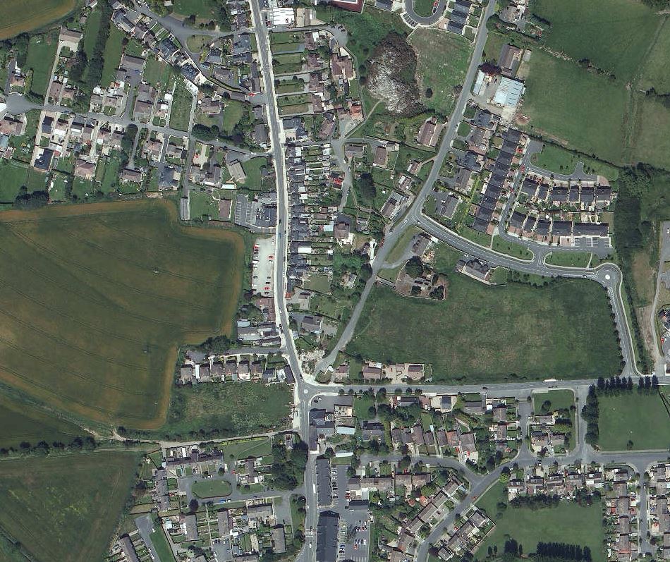
The population of Kilcoole grew from under 300 during World War II, to 550 in the 1960s. Electricity came in the 1950s, and water and sanitation systems began to be modernised. Buses began to run to Greystones and Bray, making it possible for people in Kilcoole to work away from home. Click here for some aerial views of Kilcoole in 1950.
Beginning in the 1960s and 1970s, a number of large housing estates began to be built which would change the character of Kilcoole. Since then over thirty such developments have been completed.
Maps
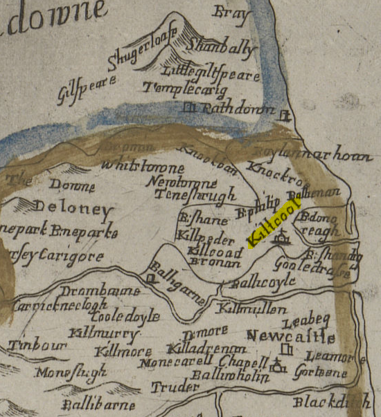
The first map to show Kilcoole is the Down Survey of 1658. This document was drawn after the Cromwellian invasion. Read more about Kilcoole on the Down Survey.
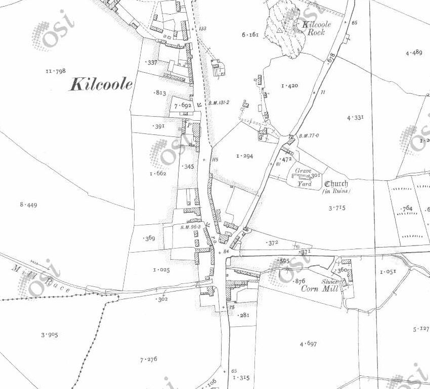
The Ordnance Survey maps of 1838 and 1908 show Kilcoole in great detail. Both of these excellent maps can be viewed online here.

Censuses and Population
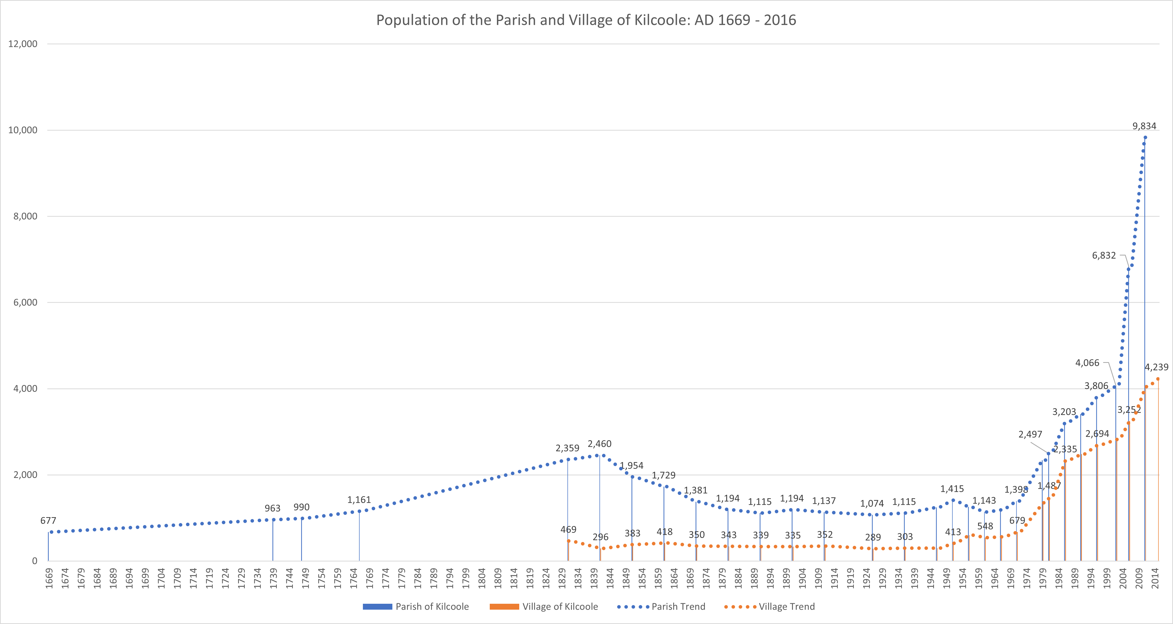
The first census of Kilcoole is the Hearth Money Rolls of 1668. These documents give us names and the number of hearths for each household. The census may not be complete as it could exclude those without substantial houses. Read more about the Kilcoole Hearth Money Rolls of 1668.
A systematic government census of the Irish population was taken every 10 years from 1821 until 1911. Sadly, only 1901 and 1911 survive in complete form. These two documents give us great insight into who lived in Kilcoole and how they lived. Read more about the Censuses of 1901 and 1911.
The following graph uses all the surviving documents to reconstruct the population of the village and parish of Kilcoole over time, from 1668 to the present. After the famine and difficult first years of Independence, Kilcoole village reached its lowest population of just under 300 people in the 1920s. The population jumped after World War II, and then began to rise rapidly starting around 1970 as new estates were built and transport to Dublin became more established. By 1980, the population of the parish had reached pre-Famine levels again. Click on the graph to zoom in.
For more information about Kilcoole’s historical population, see the book A Century of Struggle in Delgany and Kilcoole by Brian Gurrin, available in the local library.